News
The Otter Creek’s legacy is commerce — and pollution

We can have the sense of urgency and do everything right from here forward, but we may never be able, in our lifetime, to document lower phosphorus levels in Lake Champlain.
— Angie Allen, Otter Creek basin planner
This is Part I in a three-part series. The Otter Creek, Vermont’s longest river, runs through the state’s most heavily cultivated land, and thereby contributes more non-point source phosphorus pollution to Lake Champlain than any other source in Vermont, New York or Quebec. In this segment, we’ll look at the development of this problem and its potential solutions.
ADDISON COUNTY — Water connects. In dew drops, rain storms, snowmelt, the flick of a garden hose, it gathers small pieces of every living and non-living thing it touches. Tiny streams in every backyard find downward paths into each other. In Addison, Rutland and Bennington Counties, water connects again and again, throughout 936 square miles of land, until it finds the Otter Creek.
The Otter Creek is the longest river contained within Vermont’s border. It runs south-to-north, beginning in Dorset and ending in Ferrisburgh. Its headwaters are pristine; its mouth, 112 miles downstream, is the second-largest source of phosphorus pollution to Lake Champlain.
In recent years, the Otter Creek has connected the residents of its watershed in a new way. Concerns about water quality in Lake Champlain have rippled upstream, prompting advocacy for better land management to prevent pollution in the creek and its tributaries.
But along with the basin’s deeply-rooted history of land use, great nuance exists in the science and politics of measuring and limiting pollution. The complexity makes these issues difficult to identify, fund and discuss.
Particularly in Addison County, where agriculture is a beloved industry, water quality problems are woven into the fabric of our everyday lives. Throughout the past decade, scientists, politicians, volunteers and farmers have worked together to meticulously pull apart and analyze the threads of that fabric. They are now realizing what it will take to weave it back together.
SUPREMELY CALCULATED
Those who do not fish or kayak or farm or live on its banks can easily forget the Otter Creek. Official assessments by the state calculate its worth in terms of tourism, recreation and aesthetics, as well as its wetlands’ ability to dissipate potentially disastrous flood waters, as it did with Hurricane Irene, saving downtown Middlebury millions of dollars.
But in Addison County, the Otter Creek is our foundation. It is the most influential reason why colonists settled the area after the Revolutionary War, and therefore it is why we live where we do, the way we do, today.
Colonists unwittingly bound Addison County in a damaging relationship with the creek. For everything it offered early settlers, its banks inevitably became developed. Saw and grist mills, which harnessed energy from waterfalls, were essential for powering life in the late 18th century.
Colonel Thomas Sawyer discovered the jewel of the river, building the first grist mill in the lower Otter Valley on the Leicester River, a tributary to the Otter. John Sutherland of Neshobe followed suit, erecting Brandon’s first saw mill in 1780.
Both sides of the Middlebury Falls were used for hydropower in the late 1780s—Daniel Foote’s mill, on the south side, became operational in 1785, and Gamalial Painter built a mill on the north side in 1788.
In the 1790s, John Andrew Graham, U.S. Circuit Court Judge, touted Middlebury Falls for that very purpose. “Near the spot where the County Buildings are now erected is a beautiful fall of water, over a bar of solid rock, supremely calculated by Nature for the site of corn and saw mills, and iron works,” he wrote.
By then, Vergennes’ population stood at 150, supported by several mills, an iron forge, a brewery and a blacksmith shop. By 1800, the population of Addison County had breached 13,000. Addison and Rutland County’s largest cities—Rutland, Brandon, Vergennes and Middlebury—had been bound in permanent close proximity with the creek.
And while other areas of Vermont, like Burlington and Montpelier, became population centers of the state, Addison County became the land of milk and honey. Settlers built homesteads, most of which were family farms, on the creek’s banks.
This gave them access to two riches: proximity to its waters for irrigation, and an abundance of nutrient-rich soils, which were found most reliably in valleys near the creek.
In his book, Otter Creek, The Indian Road, James Petersen wrote: “Those early settlers in the Otter Creek Valley promptly discovered that you cultivate this fine bottomland, but you don’t build on it, not without inviting disastrous flooding.”
As roads and transportation developed, family farms turned into business farms. Potatoes, grain and beef cattle were driven to major markets in Boston and New York. In the mid-1800s, dairy became Vermont’s main agricultural product. Farmers began to rely on corn to feed their cows, and depended on phosphate-heavy fertilizer to grow the corn, which was federally subsidized at the time.
Farmland still flanks the Otter Creek and some of its tributaries, like the Lemon Fair and Dead Creek, today. According to 2017 data from the USDA, Addison County is home to 720 farms, including 96 dairy farms.
Many of those farms have seen consistent production since the 19th century, and farmers’ economic reasons for cultivating riverside land have not changed. Stream banks create fertile soils, and much of the land floods in the spring, making it a dangerous place for other types of development. Corn, which is usually fertilized, often survives for days when completely submerged in floodwaters, so many farmers place it near the river.
Agriculture can greatly benefit the environment, providing open space for Vermont’s mammals and birds. As opposed to impervious surfaces like roads and buildings, pastures absorb rain water, so the average acre of farmland releases fewer nutrients than the average acre of developed land.
In an ideal world, a perfectly-managed farm would not send any byproducts into the creek. Instead, crops and pastures would soak up the nutrients in fertilizer and manure, which are expensive and valuable to farmers.
Many farmers are conscious of their impact on water quality, but due to their location, available resources, and in some cases, the quantity of fertilizer crops require, most are not perfect. And in an era of rising production costs and historically low milk prices, it’s harder than ever to mandate such high expectations.
While it’s not the only source, agriculture (which refers to both the historical and modern practices of farmers) is the largest source of phosphorus to the Otter Creek. In fact, phosphorus from agriculture in the Otter Creek Watershed, at 68.9 metric tons per year, is the single largest source of phosphorus pollution to Lake Champlain.
PHOSPHORUS AND ALGAE
The state of Vermont has spent billions of dollars and half a century studying pollution in Lake Champlain’s 8,234-square-mile basin. Phosphorus is often the center of their efforts. (See sidebar.) The naturally-occurring nutrient feeds algae, and algal blooms are harmful for several reasons.
First, when algae decompose, they use oxygen, leaving zones of the lake where there isn’t enough oxygen to support a healthy ecosystem.
Second, certain types of algae, called cyanobacteria, or blue-green algae, cause skin rashes, nervous system disruption and damage to the liver. Lake Champlain has seen many beach closures because of blue-green algae, and in other parts of the state, pets have died after ingesting it.
Third, algae blooms are ugly swaths of neon green, and Vermont has a reputation for being an environmentally-conscious place. Algae blooms have a measureable impact on our tourism industry, docking the Lake Champlain region $20 million for every one-meter decrease in water clarity during the summer months, according to research from the University of Vermont.
The phosphorus that already exists in Lake Champlain will continue to cause blooms for years to come. With urgency, a sprawled network of Vermonters has taken action to prevent any more from entering the lake. Many are realizing how acutely complex the solutions will be.
FINDING THE LIMIT
In November of 2002, Eric Smeltzer, the state’s leading lake scientist at the time, had just helped complete a mammoth task. After decades of data collection and analysis, Smeltzer and others had compiled Lake Champlain’s first Total Maximum Daily Load (TMDL), and the Environmental Protection Agency had approved it.
TMDLs—laborious, 70-plus-page documents—are water restoration plans. They establish pollution limits and act as guides, suggesting methods to clean the water.
Creating Lake Champlain’s 2002 TMDL was a huge endeavor. Those who assembled the document were charged with addressing every factor that influenced the lake and creating strategies to control each of them.
Scientists like Smeltzer understood that halting all phosphorus pollution would be an impossible feat, so instead, they studied different segments of the lake to determine how much each could handle without fueling algae blooms. Smeltzer was instrumental in developing this model—an achievement for which he later earned national recognition.
The 2002 TMDL said Lake Champlain could take on 427 metric tons of phosphorus per year. That included 268 metric tons—63 percent—from Vermont.
At the time, Vermont was contributing 414 metric tons. Getting to 268 wouldn’t be easy. The state would have to reduce its phosphorus pollution by a hefty 35 percent.
Choosing the amount each sub-watershed was responsible for reducing was a decision partly based on politics. Legislators had an idea of where opportunities to reduce phosphorus existed in each region. The number of tons of reduction allocated to the Otter Creek, for example, “was a negotiated political agreement,” Smeltzer said.
The TMDL’s implementation plan said it could accomplish the target phosphorus reductions in 14 years, by 2016, with an estimated cost of $139 million.
In the spring of 2019, Smeltzer, now retired, sat in a coffee shop near his home in Waterbury and reflected, in his quiet and thorough manner, on the naivety of that goal.
“I think we created expectations that we were hoping were true, that we would meet most of our goals by then,” he said. “We started implementing that TMDL with some really good-faith efforts, and in the later 2000s, it became apparent that this was going to be a much longer, much costlier process.”
But it wasn’t for lack of trying. Governor James Douglas approved more than $60 million towards implementation strategies and pledged to “accelerate pollution reduction measures for Lake Champlain from 2006 to 2009 in every possible instance” using state, federal and private funds.
The state constantly evaluated its progress. While levels of phosphorus had decreased in wastewater treatment facilities, they had not decreased in any other sector. In 2008, the state re-evaluated the funding it would need to meet the target, hiking up the projected cost by hundreds of millions of dollars.
“Of the fifty-five individual action items specified in the Vermont implementation plan in the 2002 TMDL, five had been completed by 2008, forty-seven were in progress (some with changes in scope), and only three saw no action,” Smeltzer writes in the Vermont Journal of Environmental Law. “Despite this progress and less than three years after the first state appropriations for the Clean and Clear initiative were approved, the Vermont Senate introduced legislation declaring that the control measures under the Lake Champlain TMDL for phosphorus had failed and would not achieve the pollutant load reduction required to meet water quality standards.”
The losing battle culminated with the punctuation of a lawsuit. The Conservation Law Foundation, an environmental advocacy group, sued the EPA for its decision to approve Vermont’s 2002 TMDL. They argued that its wasteload allocations were not strict enough, that it did not plan a realistic way to reduce non-point source pollution, and that it did not account for climate change.
The Conservation Law Foundation won. In 2011, the EPA revoked its approval of the 2002 TMDL, sending Vermont back to the drawing board.
Considering the amount of time and effort Vermont had spent on creating and implementing the TMDL—along with the no man’s land its revocation left them in—the withdrawal marked a significant setback.
In a 1989 series written for the Addison Independent, reporter Steve Rosenfeld chronicled the urgency felt at the time—that Lake Champlain had reached a turning point. He quoted scientist Alan McIntosh, who said:
“If we act now and begin to understand the lake more thoroughly and take actions to protect it, there is every reason to assume it will be healthy in the future. By acting now, there is an excellent chance we can look back in 30 years and say we made the right decision.”
The new TMDL, which is the basic framework for Lake Champlain’s remediation imposed by the EPA, was published in 2016—27 years later.
A NEW GOAL
The 2016 TMDL features a more comprehensive understanding of how residents of the Lake Champlain Basin contribute to the problem.
The report illuminated exactly how complicated the clean-up effort would be. State officials reacted by passing the Vermont Clean Water Act, which pledges $2 billion and decades to the cause.
To create the new TMDL, the state contracted a company called TetraTech to take a deeper dive into the sources of phosphorus to the lake. They used what’s called the Soil and Water Assessment Tool (SWAT), which analyzed the land in small segments, splitting large watersheds into sub-watersheds, and even further by hydrological features.
By sector—wastewater, developed land, forest, stream and agriculture—SWAT further divided each basin. The updated TMDL uses these sectors to rank watersheds by the amount of pollution they need to reduce. It calls on an already-existing strategy called Tactical Basin Planning to give each of Lake Champlain’s sub-watersheds detailed frameworks to meet their respective targets.
According to the new-and-improved data, Vermont actually contributes 631 metric tons per year to Lake Champlain—that’s 217 metric tons more than the state originally thought. The state is now responsible for reducing that amount to 417 metric tons per year.
The Otter Creek Watershed, also called Basin 3, contributes 140.5 metric tons annually. The goal is to lower that number to 107.35 metric tons per year—a 23 percent reduction.
Basin 3 delivers the third-highest amount of phosphorus pollution to Lake Champlain after the Main Lake Watershed, which includes the Winooski River, at 227 metric tons per year, and the Missisquoi Bay Watershed, at 208.6 metric tons per year.
But, remove all end-of-pipe “point” sources, like wastewater treatment facilities, from consideration, and the Otter Creek becomes Lake Champlain’s biggest source of phosphorus by far. A recent report by the state auditor’s office considers this an important angle by which to look at the watershed. It analyzes all of the watersheds using only non-point source data, and in that situation, the Otter Creek’s contribution jumps to 30 percent, though this way of looking at the data is controversial.
Basin 3 is not high on the state’s list of priorities in terms of restoration—it ranks sixth there—but it presents a particular challenge because its problematic areas are dominated by one sector: agriculture.
INESCAPABLE LEGACY
Every watershed in Vermont has an ongoing plan, updated every five years, that details the health of the basin and outline strategies to improve it. In October, Otter Creek’s Tactical Basin Plan will be released to the public for the first time since Vermont passed the Clean Water Act in 2015.
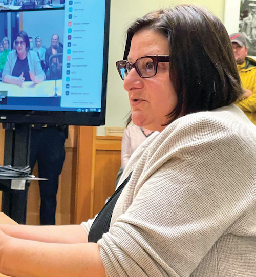
Angie Allen, a sharp newcomer to Vermont with extensive backgrounds in both aquatic science and data analytics, is the planner for Otter Creek’s basin.
In the plan, Allen will spend a lot of time talking about how and where to implement practices that reduce phosphorus pollution. She will also acknowledge that phosphorus already exists in our soils, and suggest ways to prevent it from entering the stream.
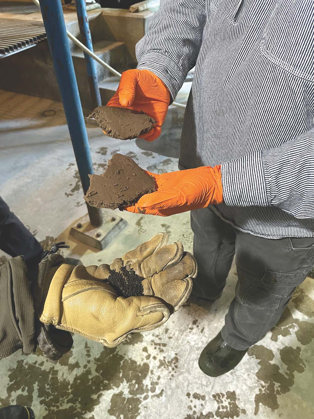
This phosphorus—the kind buried in layers of the earth’s crust—is not all new. While some of it has leached from the habits of our modern lives, much of it has been there much longer, born from the practices of farmers who did not know the environment had anything to lose from phosphate-heavy fertilizer.
When that soil erodes, the earth spews phosphorus-laden matter into the water. Allen calls this “legacy phosphorus.”
“Legacy is still a really important part of the phosphorus story, particularly in Basin 3,” she said. “They’ve been farming those valley bottoms and farming intensively near Lake Champlain for hundreds of years. The length of time that agriculture has been an important part of the landscape here means that we’ve got a lot of work to do.”
The presence of legacy phosphorus requires several things. First, landowners and municipalities can work to bolster stream banks by installing buffers between land and water.
Second, the legacy mandates a new school of thought surrounding Otter Creek’s water quality issues. Its presence, proven through SWAT modeling and abundant in the language of the basin’s chief analyst, gives a window into the history of the area, helplessly intertwined with its present.
It should allow those ensnared in the basin’s problems a measure of forgiveness, if only for a moment; while every person who resides in the Otter Creek basin contributes to its phosphorus problem, we shoulder the burden handed down from the basin’s first residents.
Quick fixes do not exist. When a particle of phosphorus enters the lake, it stays there until something uses or removes it.
“The phosphorus legacy is there,” Allen said. “It’s inescapable. We have the sense of urgency and are doing everything we can, but we may never be able, in our lifetime, to document lower phosphorus levels in Lake Champlain. We’re implementing projects across all sectors and best management practices and doing the best we can do now and into the future, but only time will tell if it’s enough to actually see phosphorous numbers change in the lake. We have to take the long view on this issue.”
Are we wasting our time and money to try?
Most experts don’t think so. In a February 2019 column, Vermont Agency of Natural Resources Secretary Julie Moore wrote that the success of clean water efforts will take a combination of urgency and persistence.
“A river cuts through rock not only because of its immediate force, but largely from its persistence over time,” Moore wrote. “If we are willing to apply pressure over an extended period, we can, and we will, reach our water quality goals.”
Eric Smeltzer, reflecting again in the coffee shop, sees this persistence as a duty.
“I liken it to these massive federal efforts, like the war on drugs and the war on poverty,” he said. “You’re not going to get near-term success and completion, but the idea of giving up and throwing up your hands is totally unacceptable. It’s an obligation we have as a society to work at it. I see it that way.”
(Click here to read Part II.)
(Giving Stream: Series home.)
More News
News
High court rules against Vekos license reinstatement
Addison County’s top prosecutor will not yet return to court after the Supreme Court said … (read more)
News
Middlebury picks gas over electric in sludge process
It’s a move members of the local energy committee argued was shortsighted.
News

Bristol summer program gets students out in their community
Local high school students have collaborated with artists and local professionals on two p … (read more)